"I'm making a map!"
The nook in our kitchen is perpetually covered with drawing paper, construction paper, markers, crayons and scissors. Wyatt, our five-year-old, if we put any of it away, promptly drags it all out again. Crafts, especially drawing, is quite commonplace.
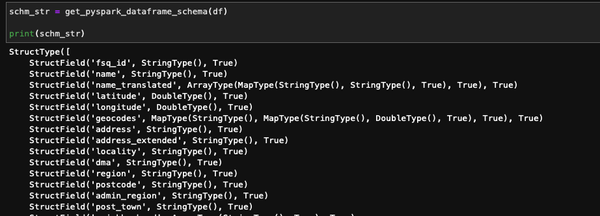
This statement a