Upper Stehekin - Jumping Headlong into Packrafting

I don't remember paddling in the 90's. I was born in 1992.
Although I knew Taylor was younger than me, this really solidified the difference in our ages...15 years...wow. We were hiking down the trail on the east side of Cascade Pass, which separates the Cascade watershed to the west, and the Stehekin watershed to the east, to paddle the Stehekin from the top to Lake Chelan.
A little over a week earlier, looking at the map, I got the idea to hike in from the headwaters and do as much of the Stehekin as possible down to Lake Chelan using packrafts. Although I have been fantasizing about the portability and versatility of packrafts for a while, it was not until a week earlier when we actually had one of our own, and trips like this were a real possibility.
I had a long weekend free to explore. The upper Stehekin was begging to be explored. The right craft was sitting in a box on the kitchen table. I just needed somebody with a similar curiosity and penchant for type two fun.
Knowing Taylor loves exploring remote rivers and is not afraid to put significant effort into it (type two fun), he was a good candidate if he was free. Thankfully he was free, and predictably interested.
By the next day, we had checked water levels and bought ferry tickets across Lake Chelan. We were committed. It was time to open the box, figure out how this pack raft thing worked, and get ready for this inaugural pack rafting trip.
Now, heading into the headwaters of the Stehekin on the east side of Cascade Pass this statement made me laugh. "I was born in 1992." When Taylor was born, I was a freshman in high school. Although I do not consider myself old, apparently I am old enough to necessitate recruiting from younger generations for my ideas with a high probability for type two fun.
The Stehekin Plan
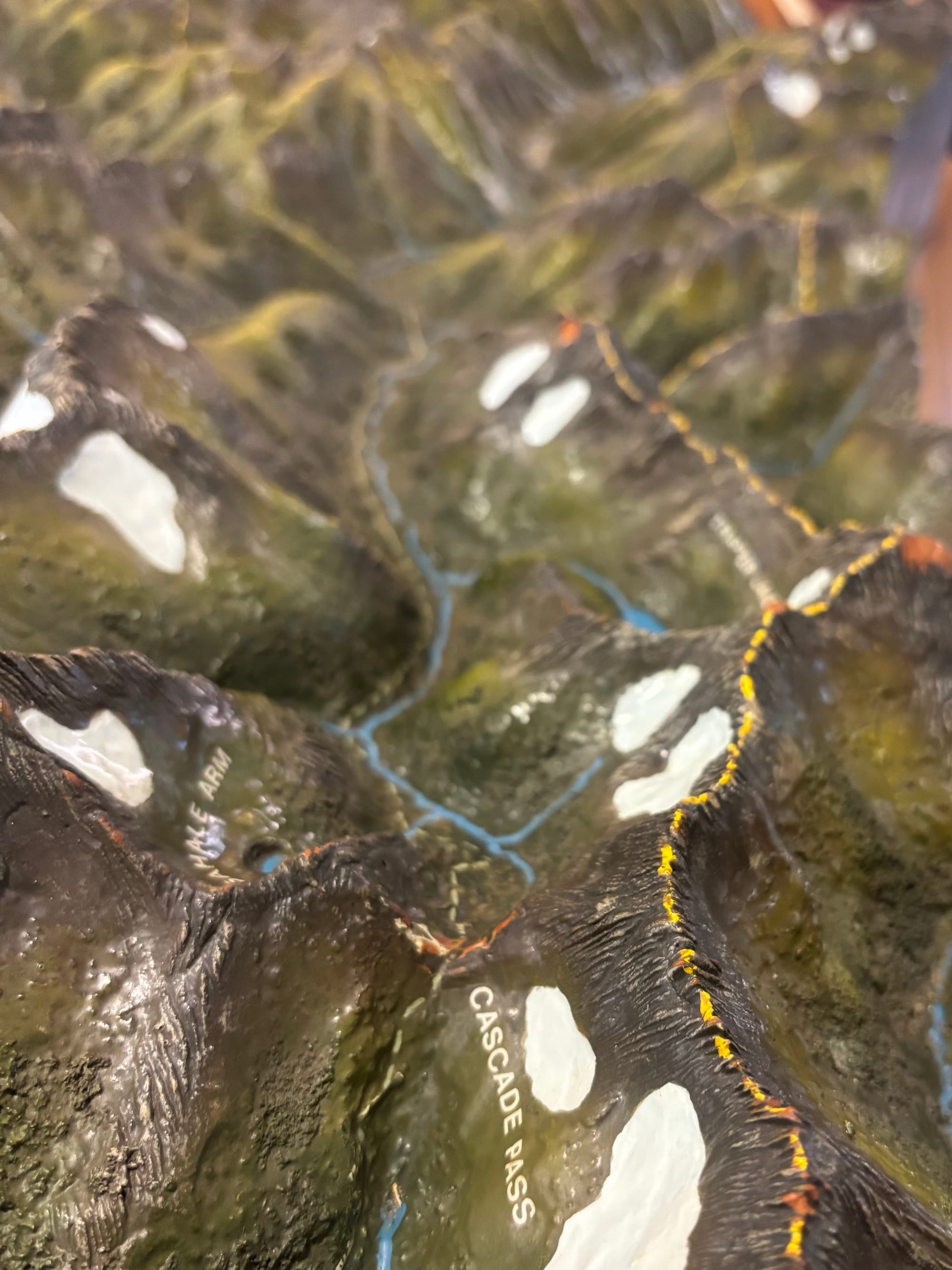
The Stehekin likely is one of the most protected, remote and pristine watersheds in the lower 48 conterminous United States. The watershed starts on the south side of North Cascades National Park, a comparatively little-known National Park arguably every bit as spectacular, maybe even more so, than Glacier. Similar to Glacier, North Cascades' northern boundary abuts with the Canadian border and the granite topography is entirely glacial carved.
It flows generally east until the confluence with Bridge Creek to flow south into Lake Chelan. Along the way, a few significant tributaries add to the flow including Flat Creek, Bridge Creek and Agnes Creek. Although we knew the additional flow from these tributaries would be beneficial, we had no idea how much so...especially in the case of Flat Creek.
Looking at the map revealed the Stehekin is paralleled by a trail for the entire length. Theoretically, this enables simply following the river on foot until there is enough water to paddle, and also makes portaging around hazards much easier.
Further, the closest place to access the headwaters does not mandate walking up from the bottom. Rather, it is possible to hike up over Cascade Pass and drop into the headwaters. It is not necessary to backtrack, walk up just to paddle down, which adds to the unique allure.
The Stehekin Reality
Taylor and I both started driving on Thursday afternoon, planning to meet at Fields Landing on Lake Chelan at 07:00 Friday morning to take one car to the Cascade Pass trailhead. Taylor was coming from near Bremerton, and I was coming from Olympia. Under the best conditions, from Olympia, this is a four hour drive. Thursday 03 July, with all of Seattle trying to get over Snoqualmie Pass with construction...was not the best of conditions.
I rolled into the small pullout next to Fields Landing a little after 01:00. Taylor was already sleeping in his Subaru. I tried to quietly pull in and climb into the back of the truck to sleep. With the keys in my pocket, when I bent over to pull out my sleeping bag, something in my pocket hit the panic button on the key fob. So much for being quiet.
The next morning, they opened the gate early in anticipation for the Fourth of July, so we were able to leave Taylor's Subaru there and start driving around to the trailhead promptly at 07:00. With a four and a half hour drive ahead of us, we did not want to waste time.
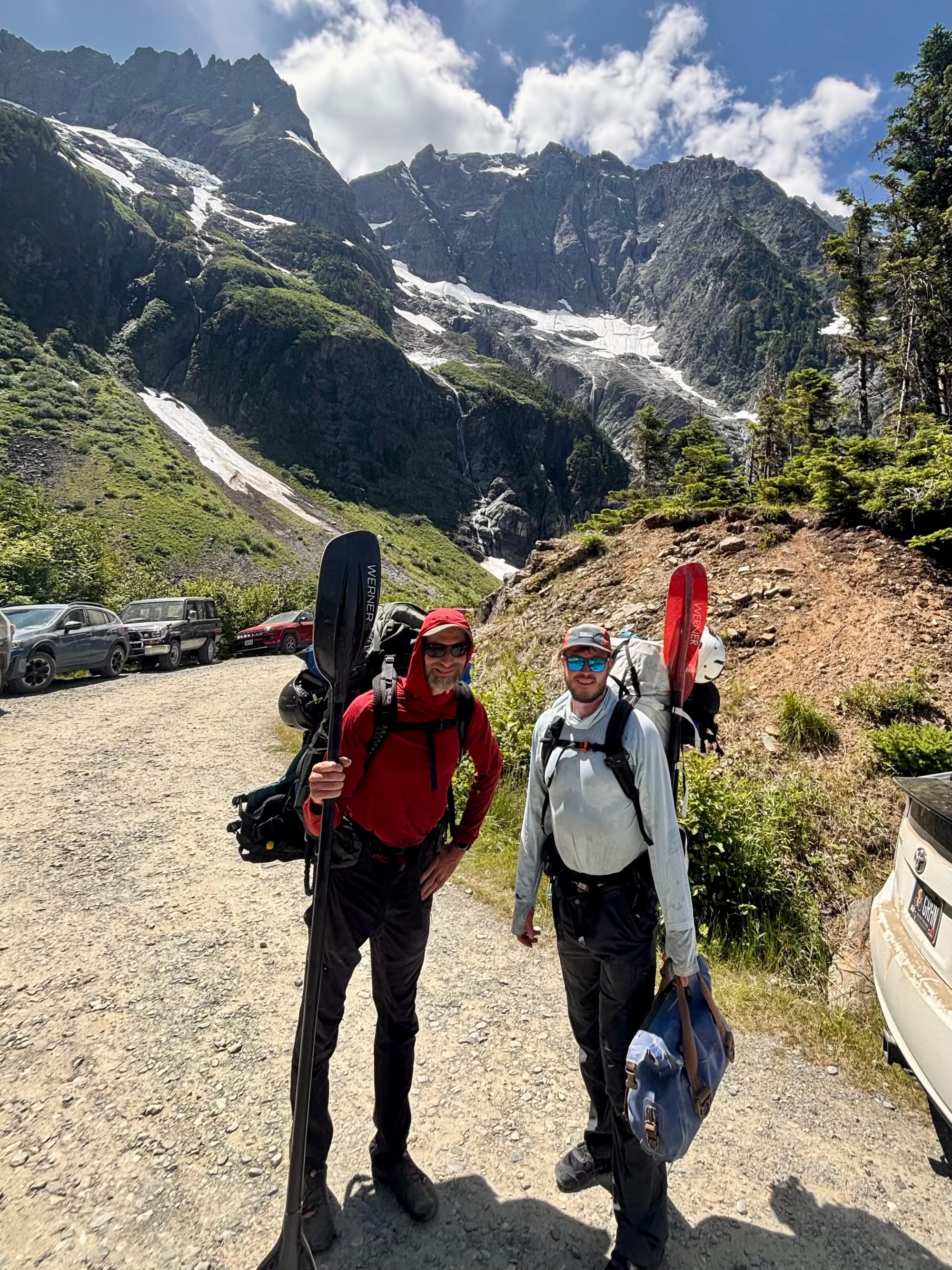
After picking up the permit at the backcountry ranger station, and following some Subaru from California driving between 9 and 15 miles per hour (not a lie, ask Taylor) the entire way up the forest road to the Cascade Pass trailhead, it was 13:00 (1pm) by the time we finally had packs on and were walking up the trail.
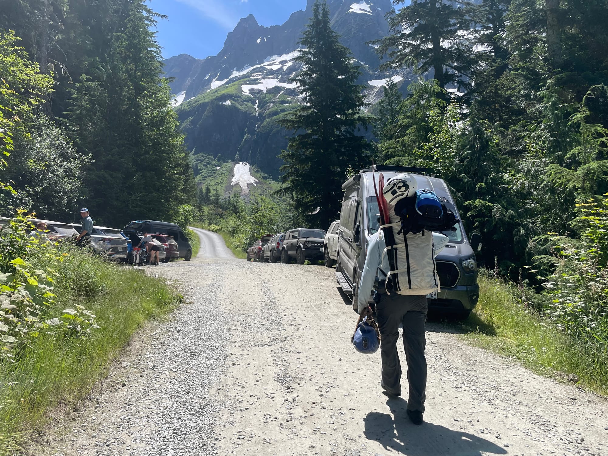
The trail up to Cascade Pass, although well used, is also very well maintained. It took us right at an hour to climb the roughly 2,300 feet in just under three miles. At the summit, I told Taylor this was a relief. I was anticipating the climb over the pass to be our largest obstacle, and we had cruised it. This was, in retrospect, a foreboding foreshadowing. It is never this easy.
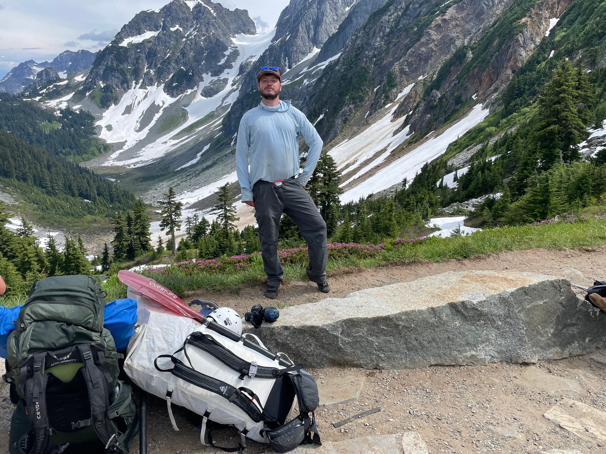
Taylor, thankfully, had done quite a bit more intel gathering before the trip. Having scrutinized topos and aerial imagery, he had a few ideas of potential accesses. The first we scouted looked promising, until we looked at the, "maybe a fun rapid," just downstream. This rapid turned out to be an unrunnable cascade we could not see the bottom of when scouting.
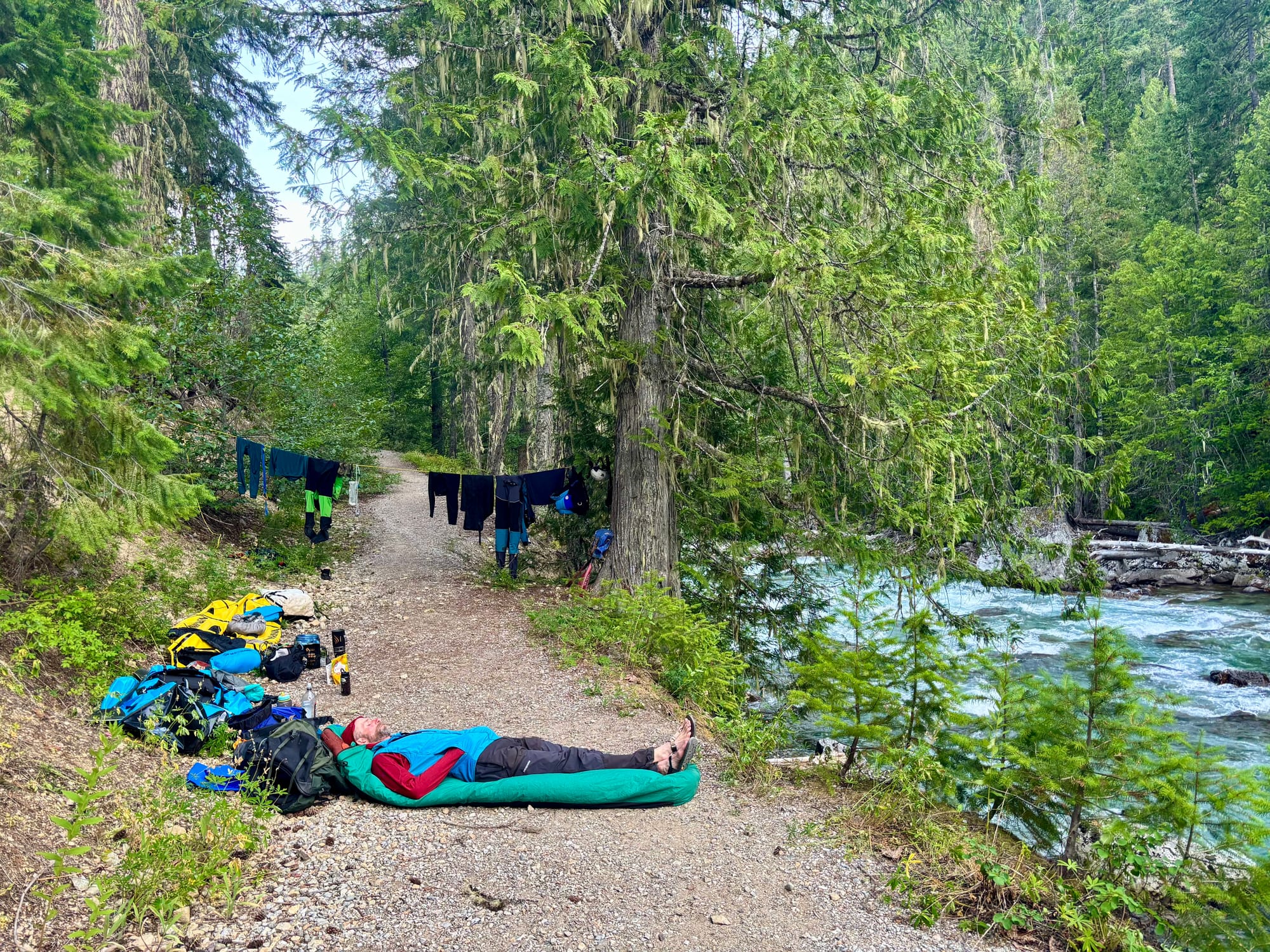
We shouldered our packs and headed downstream. By this time it was nearly 19:00 (7pm), and we needed to camp. Clearly getting in our boats today was completely out of the question. We made decent time and got to Cottonwood camp, a really nice small backcountry camp with food lockers for bears, which is really convenient both for storing food, and using as a table.
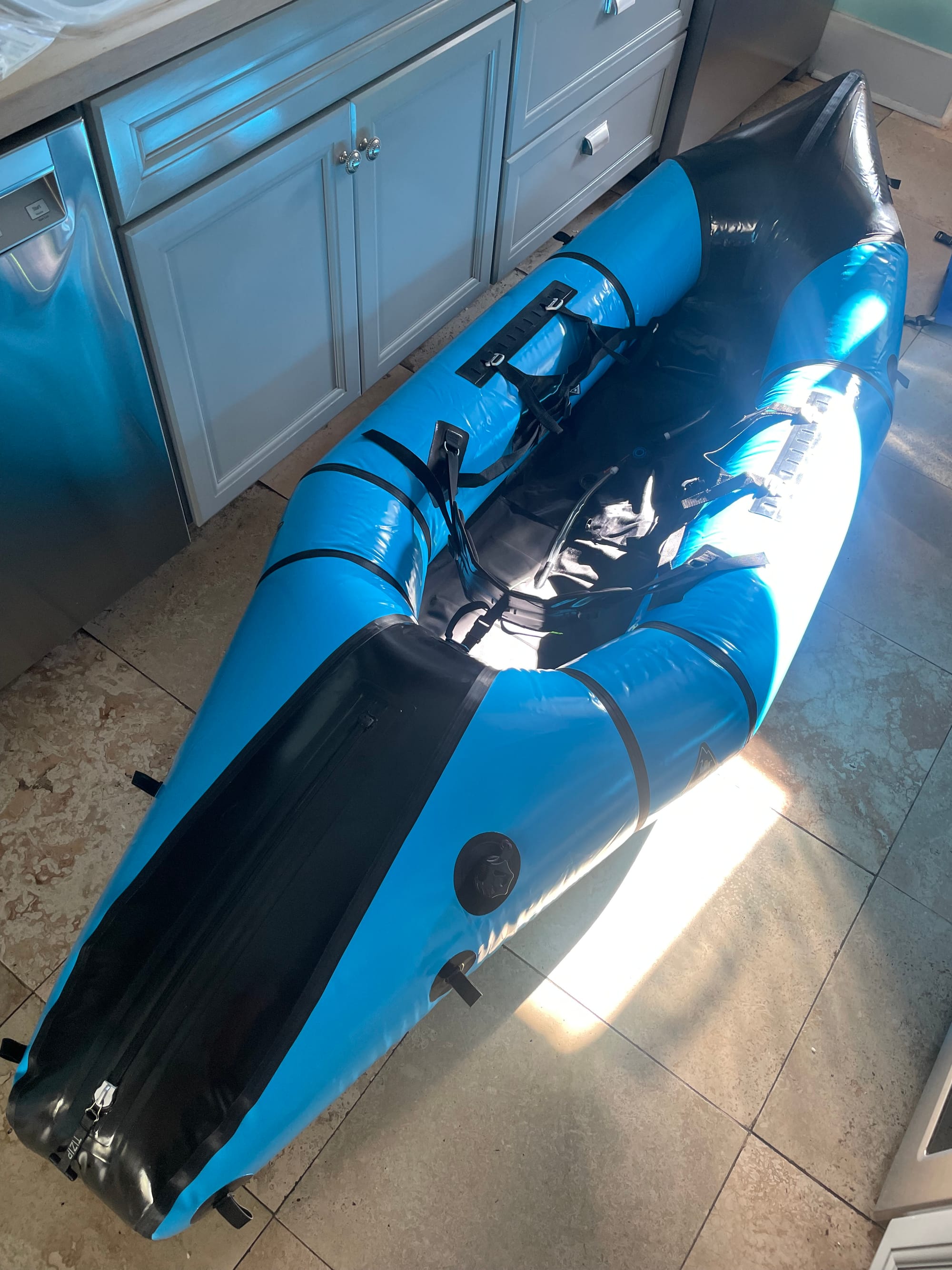
The next morning we transitioned to river mode. Packing up, I was really impressed with how well thought out the Alpaka Cargo Fly system is when paired with the internal dry bags. The Cargo Fly is a drysuit zipper on the back of the packraft. The Cargo Fly makes it possible to slide the drybags inside the air chamber.
These drybags are barely smaller than the internal diameter of the side tubes of the air chamber on either side of the paddler. There are clips on the outside of the drybags to secure them inside the air chamber. This aligns the drybags on either side of the paddler, and prevents them from moving forward or aft. This is quite nice when paddling, and even nicer when portaging...which I tested quite extensively later that day.
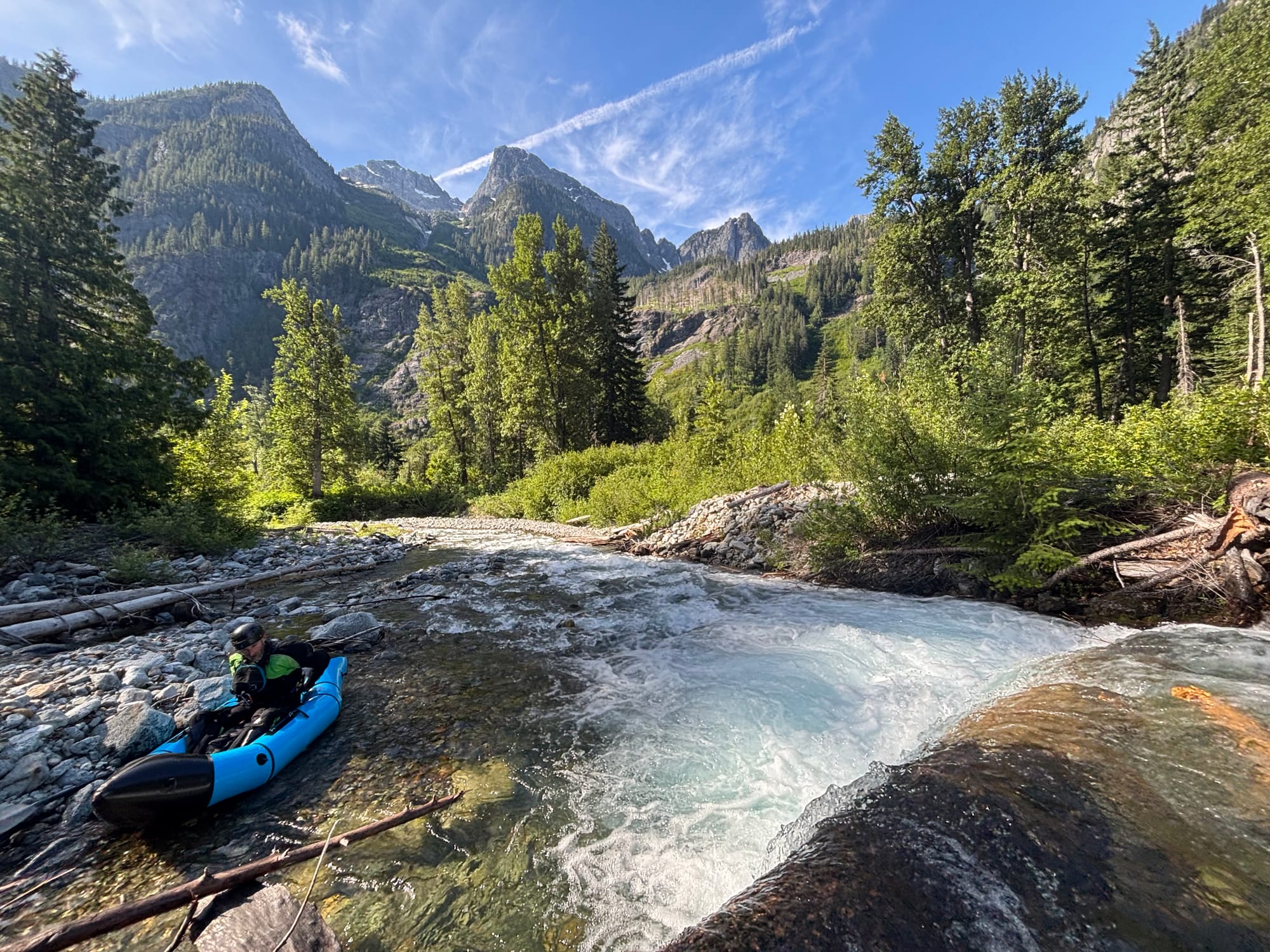
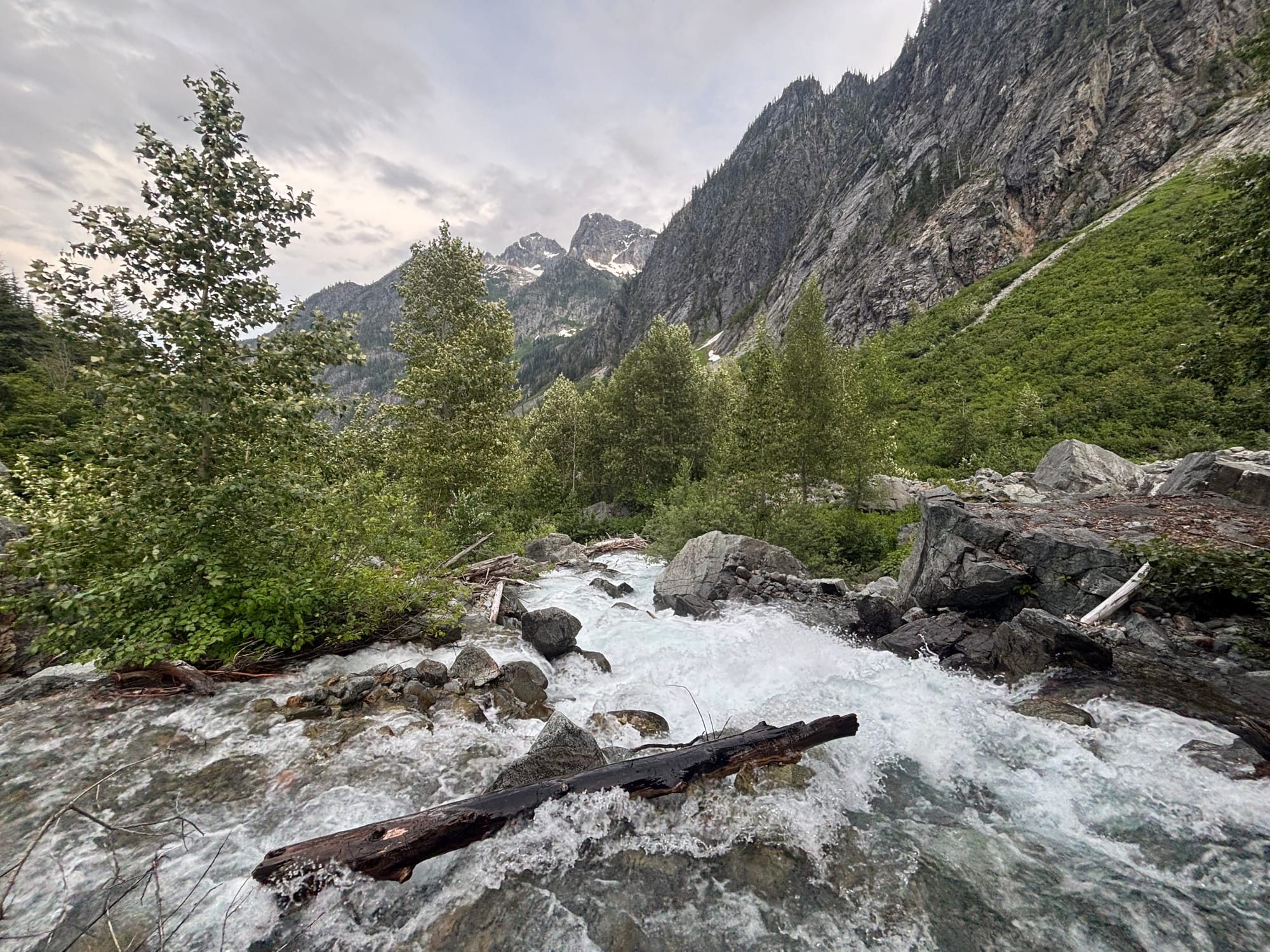
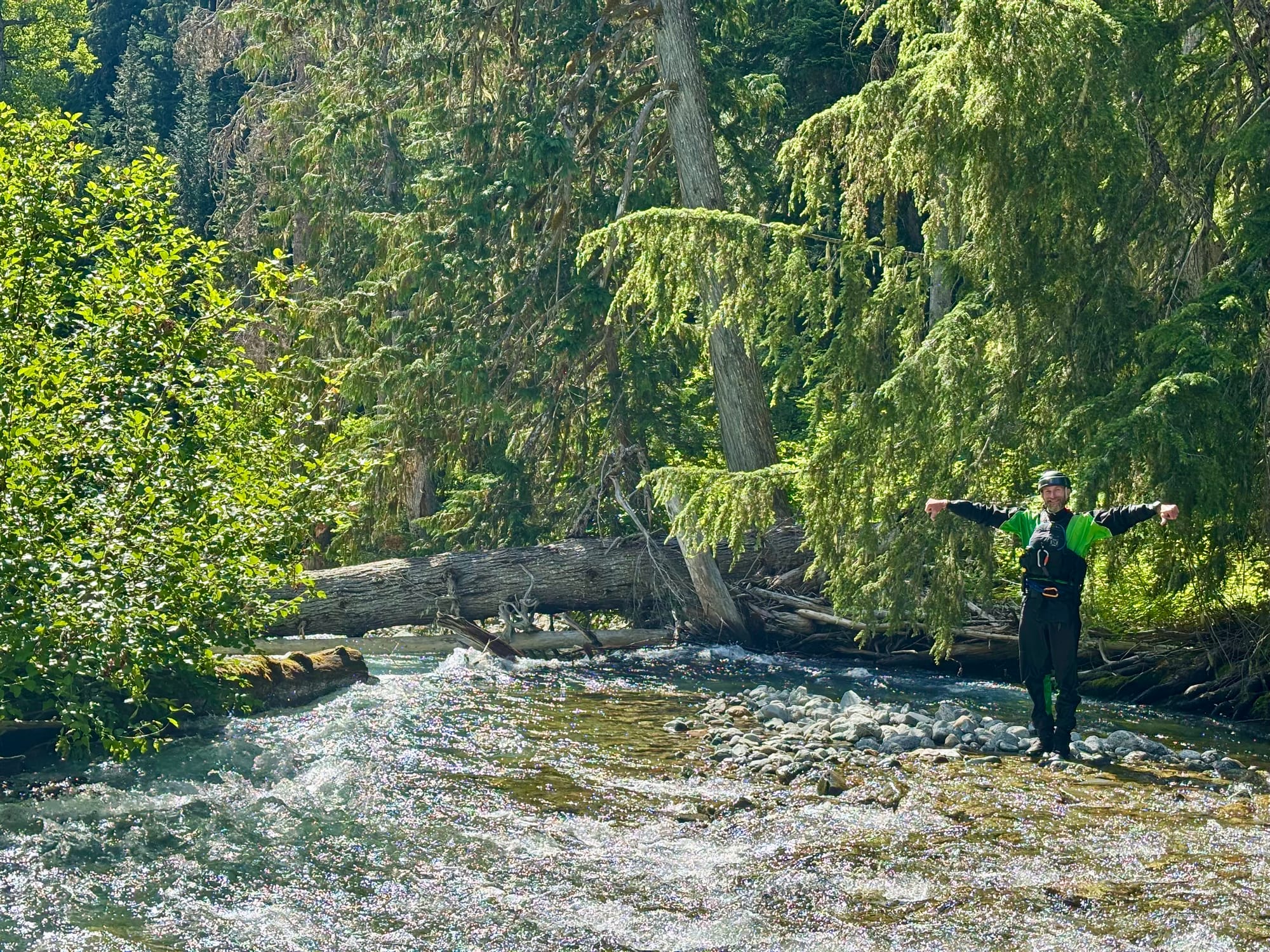
We were excited to finally be getting in our boats on the Stehekin on what very well may be a first descent of the upper Stehekin. Although I doubt there was more than 120 cfs in the river, it was enough to float our small boats.
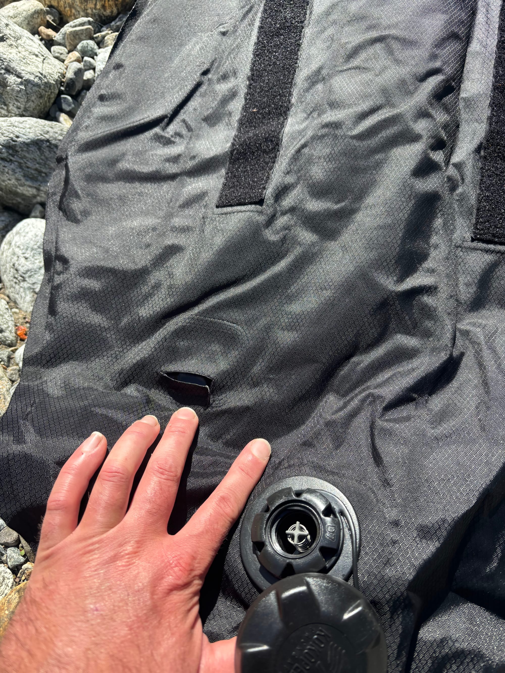
I opted to put in right below where the river was pouring over a log forming a two to three foot drop. Taylor opted to put in and run this first small drop. Immediately below, he caught the first eddy, and pulled out a completely deflated floor in his boat.
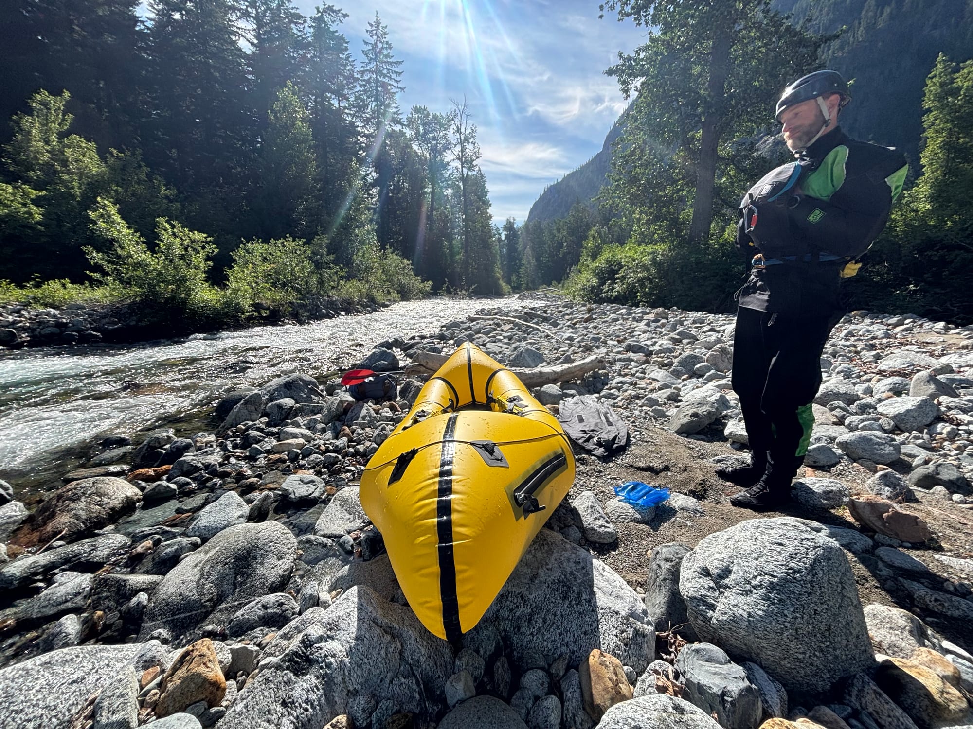
Closer inspection revealed a tear on the top side of the floor right behind the seat, rather strange. We tried to dry it out and repair it with one of the repair patches from the repair kit. A half hour later, we had patched the floor, and were ready to head downstream again. Seconds after launching, it was flat again.
To Taylor's credit, he did not let this dissuade him from continuing. He came up with a rather creative technique of leaning back on the rear air chamber to keep from hitting rocks with his backside. Later in the day, this evolved into slinging the backband under him as a makeshift seat. I have to give Taylor credit for his enthusiasm and creativity, not letting the deflated floor affect enjoying the trip.
Although very low volume, there was no shortage of gradient. This gradient was constant. Consequently, there was plenty of whitewater, but no real distinct rapids until about mile or so downstream.
Our first rapid was a fun boogie through some larger boulders in about three closely stacked stages. Thankfully, it was free of wood, and provided a chance to get to know my boat a little better.
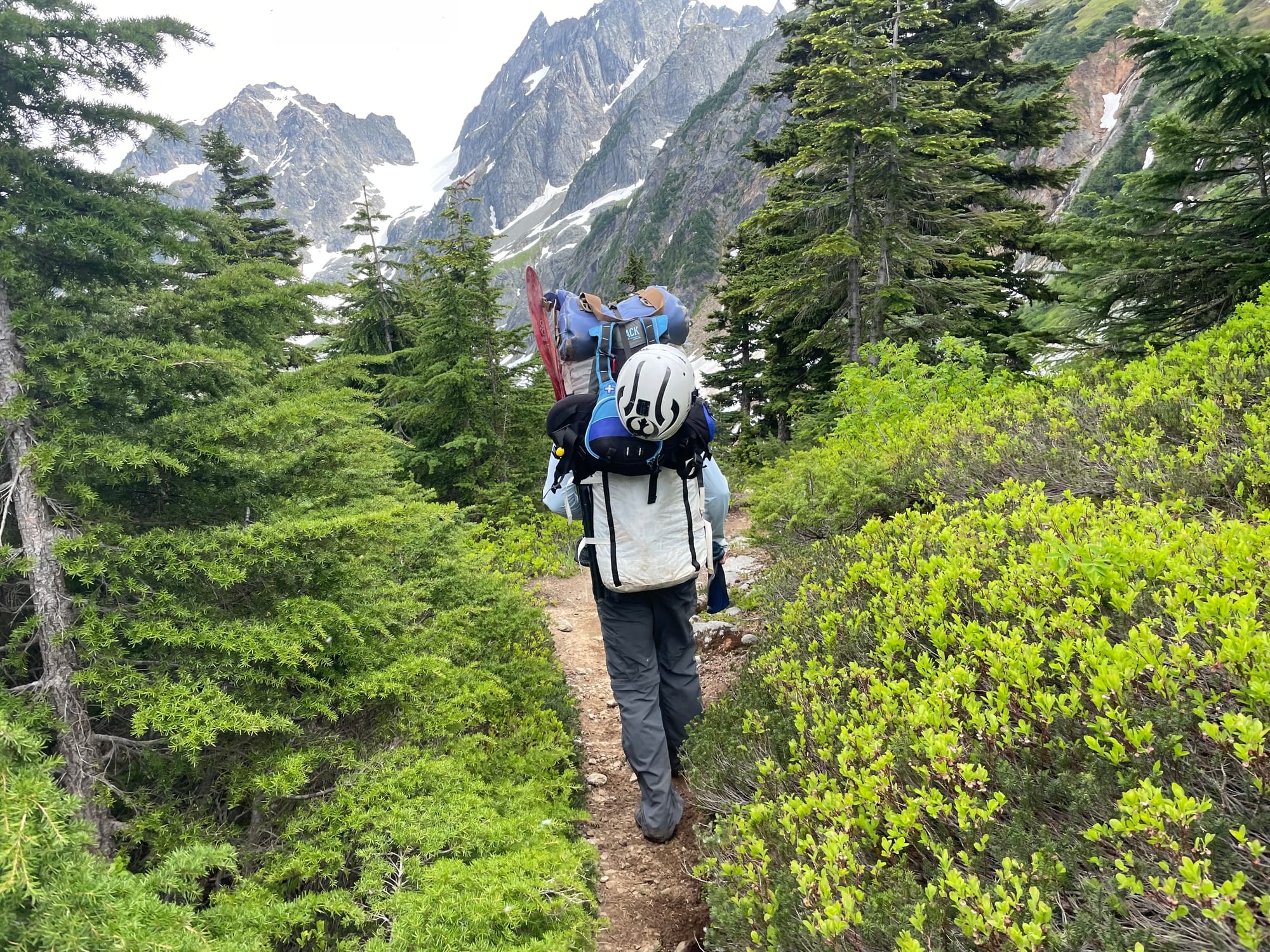
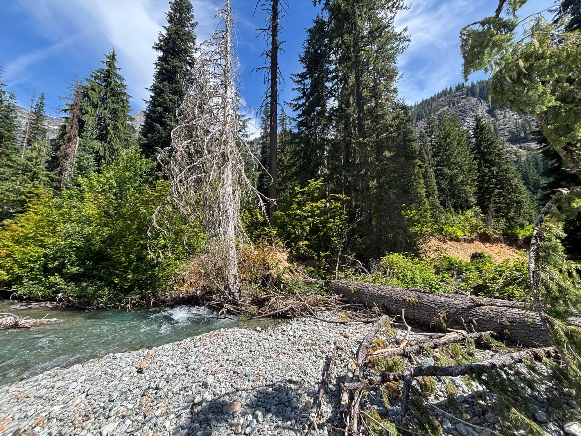
Not far below this, we encountered our first logjam, which surprised neither of us. We were anticipating wood. We both shouldered our boats, worked our way around and through the logjam on shore, relaunched and headed downstream.
Not more than an eighth of a mile later, we encountered our second log jam. Again, we did not think much of shouldering our boats and working our way around the wood. Below this log jam, there was another less than 200 meters downstream.
The self bailing packrafts definitely have an advantage for these conditions, when you need to be in and out of the boat frequently and quickly. I was impressed with how easy it was to simply step out, grab the boat, hoist it onto my shoulder, and start walking. Once below, I did not need a good place to launch. Toss the boat into the water, hop in it, and I was headed downstream. Sometimes I put the thigh straps back on. More often than not, I did not bother.
The trend continued with the log jams progressively getting larger, and harder to get around. At the seventh, Taylor guessed the count would be 16. I told him I love optimists.
At the 14th, a very large logjam, Taylor suggested we try to make our way to the trail and walk downstream a bit to try and get past this. I figured getting to the trail could not be worse than trying to get over, around and through log jams at river level. We shouldered our boats, and headed into the riparian underbrush. According to the map, the trail was about a quarter mile from the river at this point across the floodplain.
The floodplain was thick with alders so close we barely could get between them. Where there were not alders, it was quintessential Pacific Northwest rainforest undergrowth with downed logs the size of giants, and ferns growing taller than we are. After nearly an hour of fighting our way through this, we followed a small stream back toward the river hoping it may lead us to below the worst of the wood.
Arriving at the riverside, we were two logjams downstream of where we had left the river nearly an hour earlier, and about 150 feet downstream. We resolved to stay at river level for the rest of the logjams. Trying to get to the trail was worse.
Taylor was convinced it would improve when we picked up more flow from Flat Creek, which was less than mile downstream. It had taken us nearly three hours to go less than two. We continued climbing, passing boats, and working our way around and through the logjams downstream.
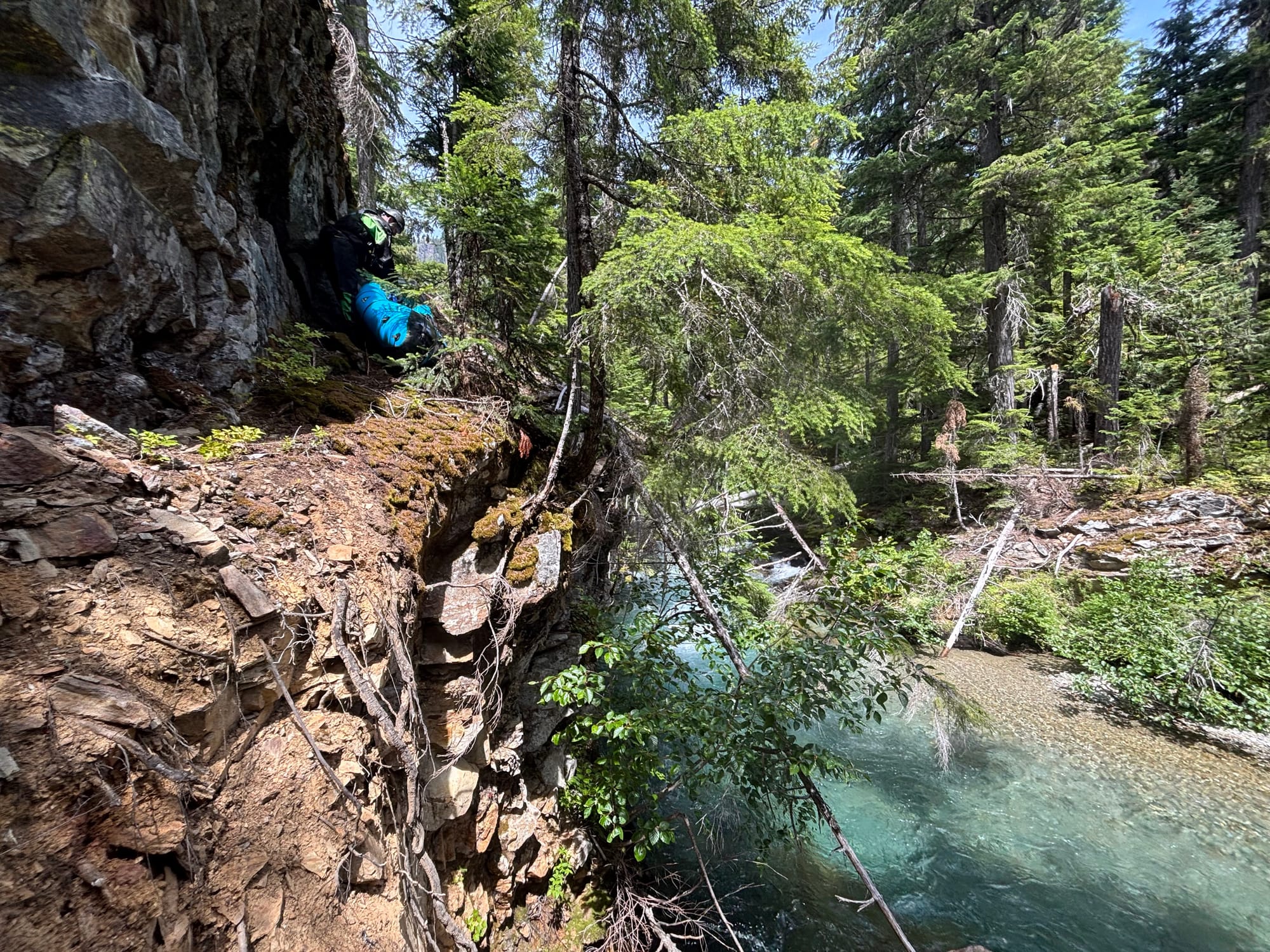
At something like the 19th or 20th logjam, the valley was starting to narrow. When we looked to find the best route around a logjam, we were able to just go up to a low forested bench on river right. This was dramatically easier than the brush and dense alders we had been fighting for the last few hours. Below the logjam, we realized although not a huge cliff, we were cliffed out about 30 feet above the river. We found a notch through the cliff line and proceeded to work our way down. It was steep and exposed enough, we opted not to carry boats, but rather to pass them down between comparatively stable positions.
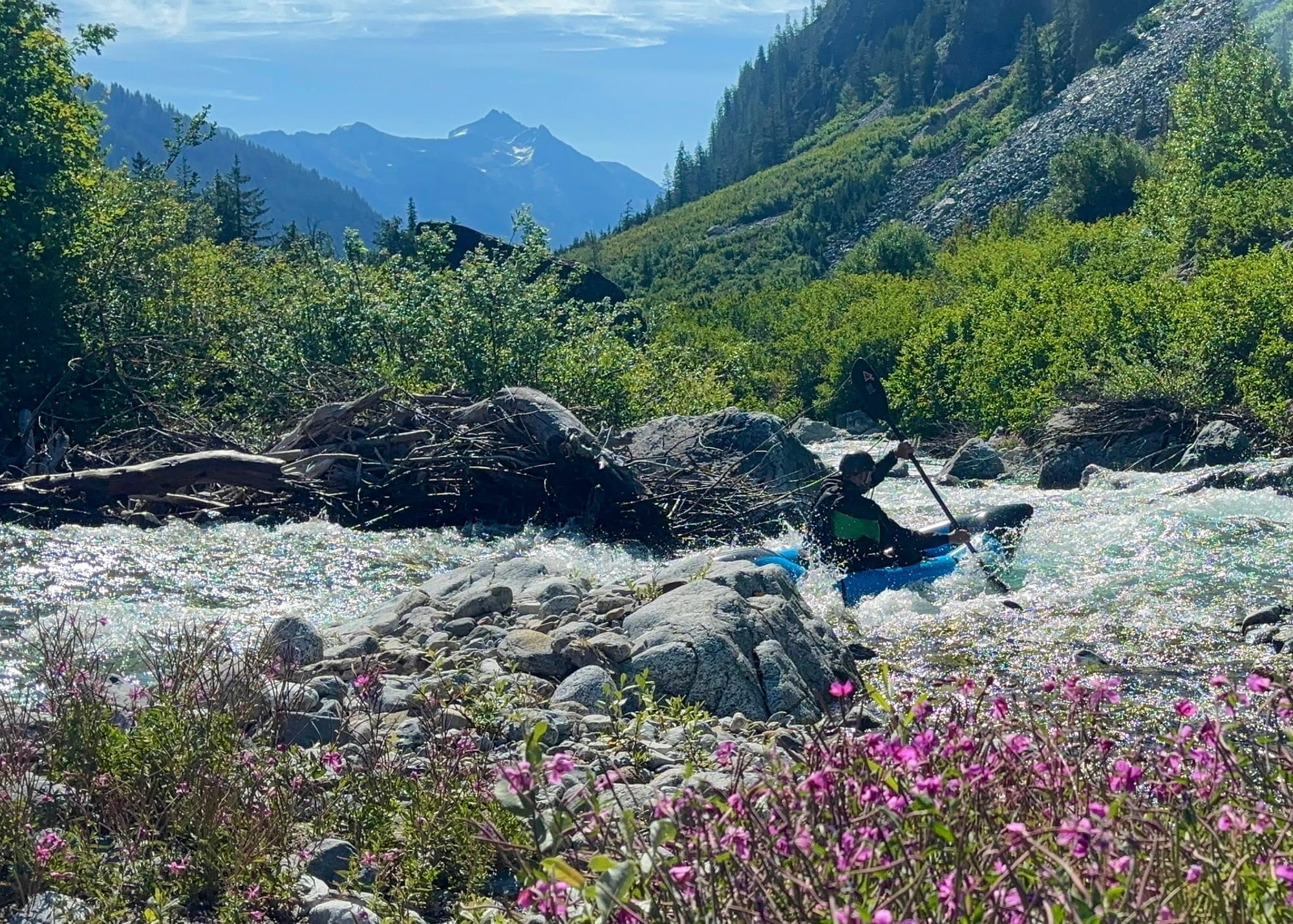
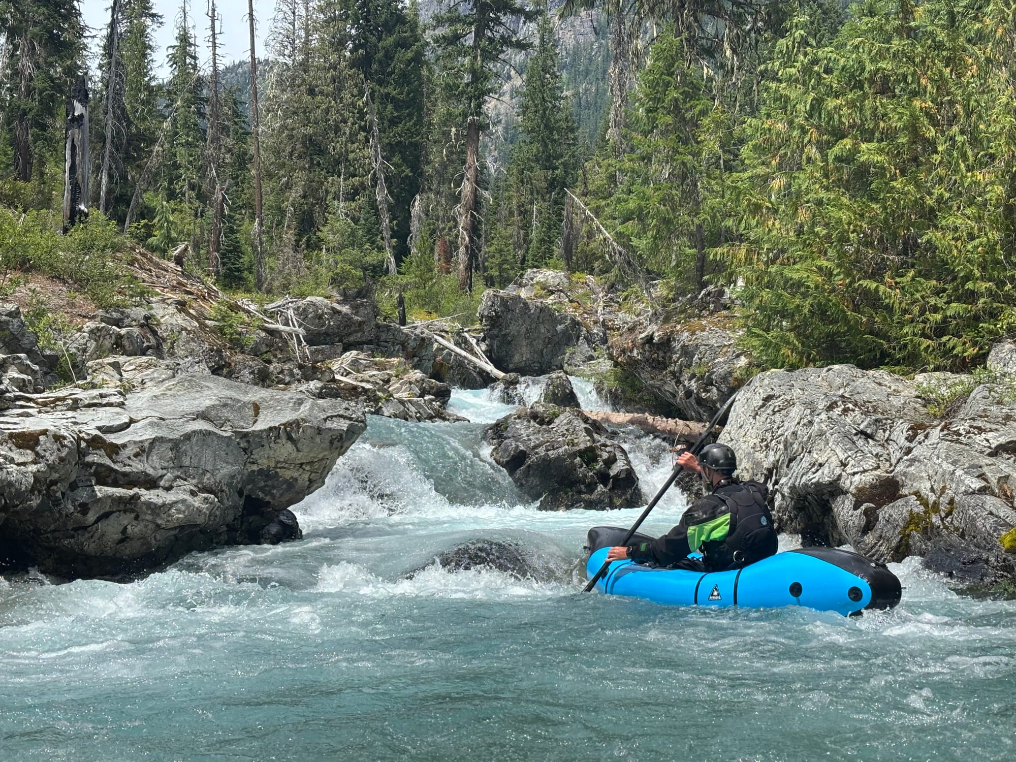
Finally, back in the river, we were able to paddle a fun easy II-III rapid. It appeared to continue downstream. I was leading, and enjoyed the next III rapid. Catching the eddy at the bottom, I looked up just in time to see Taylor's boat fold in half around about a four inch diameter stick extending up from the riverbed, barely visible at water level.
The river volume was still fairly small, so Taylor was in about chest deep water trying to free his boat. Thankfully, he was not in any danger, but the boat was completely wrapped around the wood...taco-ed in half around it.
I jumped out of my boat and tossed in up on shore before heading up to help Taylor free his boat. About the time I got out into the water to help him, he managed to get the branch free. The branch, the boat and his paddle all started heading downstream. I aggressively swam downstream and caught his paddle, which was moving the fastest. The boat was right behind me. I managed to get them all into an eddy. Taylor was not far behind.
Not far below, the river dropped over a fun looking shelf of rock, a sliding drop to the left into a chute exiting back to the right around a blind corner. After retrieving my boat, I headed up and over the rise to see what was below.
What we were looking at was the entrance to a big multi-stage class V drop. Without some really badly placed wood, the entire drop would go surprisingly well.
Right at the drop was a pack bridge for the Flat Creek trail. This meant Flat Creek was just below. Finally, we would pick up some volume, and hopefully less logjams.
I could be wrong, but I think the additional flow will mean we are done with logjams.
Taylor was confident portaging wood was behind us. Not two turns below Flat Creek, we were shouldering our boats again. I ribbed Taylor about it, "You could be wrong..."
To his credit, he was right. Although we had to portage three logjams between Flat Creek and the confluence with Bridge Creek, it was very manageable. We were finally making downstream progress. It felt like a breath of fresh air.
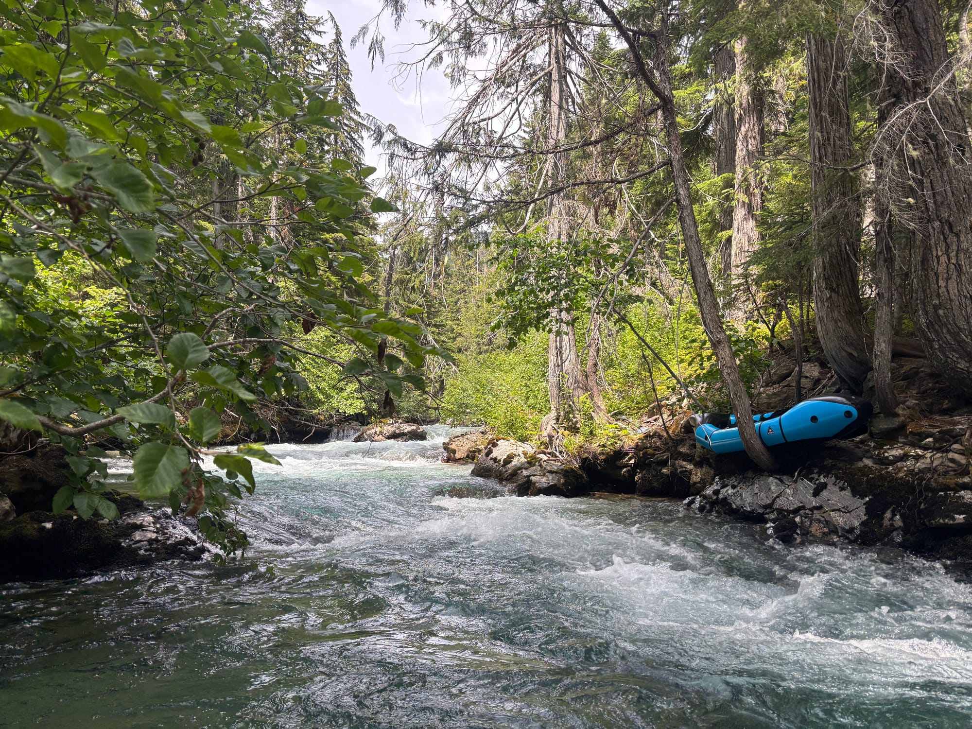
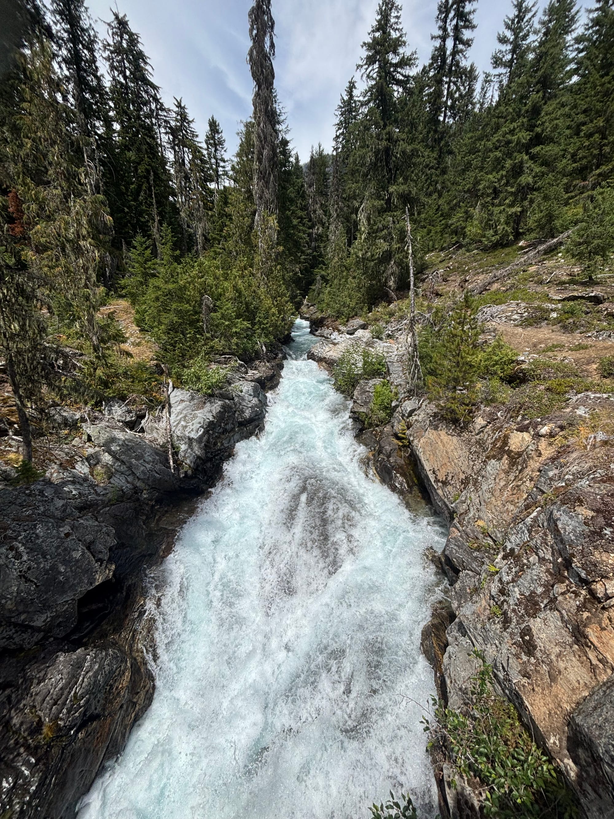
Coming around a corner, the gradient picked up a bit, there were larger rocks in the river. It was a fun class III rapid ending at the confluence with Bridge Creek.
It is ironic the Stehekin retains the name below this confluence. The Stehekin only contributes about 1/3 of the water. Bridge Creek contributes easily 2/3 of the water. From the confluence, dropping into the first rapid, it really feels like a river.
The first part of this drop is a lot of fun. The bottom part chokes into a narrow chute dropping into a sticky hole with a slightly undercut rock on the right side. We opted not to run this latter part.
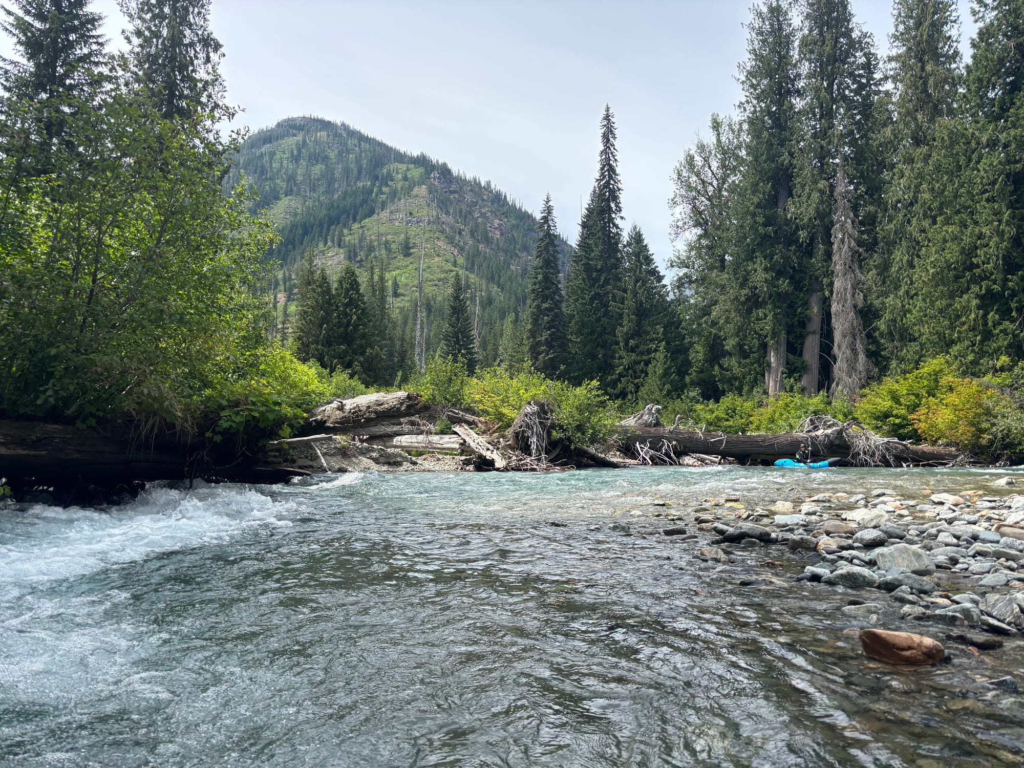
From here to the access right above Tumwater Canyon, the Stehekin is an absolute blast, continuous class III with no wood. Where the road ends above Tumwater canyon, this is the easiest place to get out of the river, and for us, made a good camp.
On the bench above camp, Taylor discovered plentiful ripe huckleberries. Following a freeze dried dinner, we enjoyed a dessert of huckleberries, a very tasty treat.
The next morning we packed up our kit into backpacks, shouldered packs and walked the mile and a half around Tumwater. Arriving at High Bridge, where the Stehekin bus turns around, Taylor proposed to catch the bus to town.
When we got to High Bridge, four kayakers were getting ready to head downstream. We caught up and talked for a few minutes. They had a great weekend getting a lap on Agnes Creek on Saturday, a committing, stout, incredibly steep, but very runnable gorge accessible from the Pacific Crest Trail. Today they had gone up to get a lap on Tumwater, before packing up their camp at High Bridge, and heading downstream.
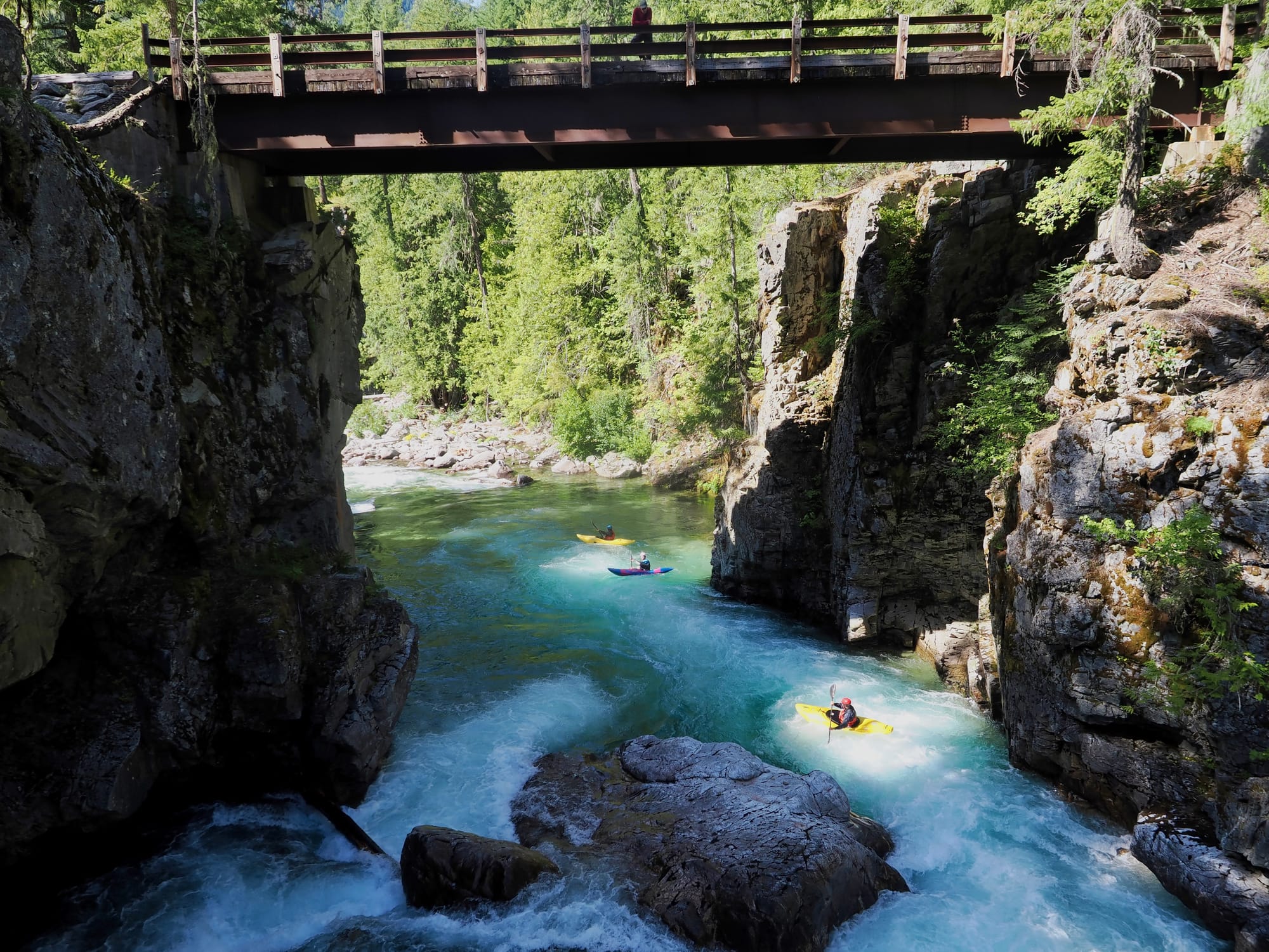
We watched them paddle the rapid below the bridge, and disappear around the corner. It looked absolutely spectacular. We could ride seven miles on a dusty road on a bus, or do the same seven miles on one of the most spectacularly beautiful rivers I have ever seen in my life.
Taylor, initially, was not hugely motivated to get back on the water. We already were packed up, and the floor of his boat still did not have a floor holding air. For somebody who loves to propose fun ideas like myself, Taylor is fun to do trips with. Even if not initially motivated, all I have to do is plant the idea, and let him talk himself into it. About 45 minutes later, we unpacked our packs, donned drysuits, packed gear into the packrafts, and were headed downstream on a gorgeous river.
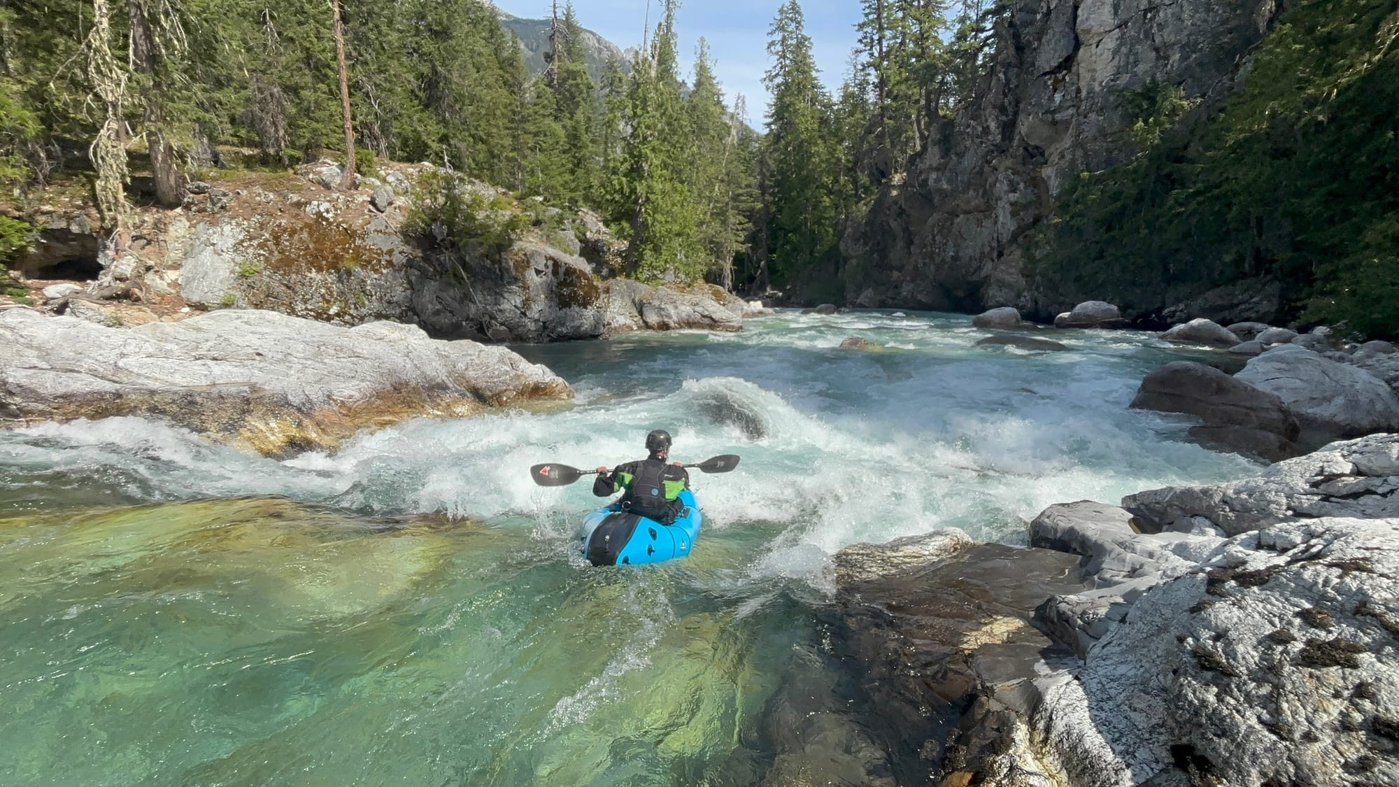
The first couple of rapids under and right below High Bridge were fun and busy class III+. Below this, the river calmed down to an enjoyable float on consistent current to the town of Stehekin. The only real hazards were some large logjams, thankfully avoidable. For us, with strong boat control skills, none of the wood was a significant challenge, but still, for somebody looking to simply float from High Bridge down, this is important to be aware of. Wood still is a hazard in this section, but for anybody with good boat control, avoidable.
Any trip to the town of Stehekin is not complete without a stop at the Stehekin bakery. Since I forgot coffee filters, I was grateful to stop for coffee with a homemade quiche followed by a slice of huckleberry pie. Life indeed is good.
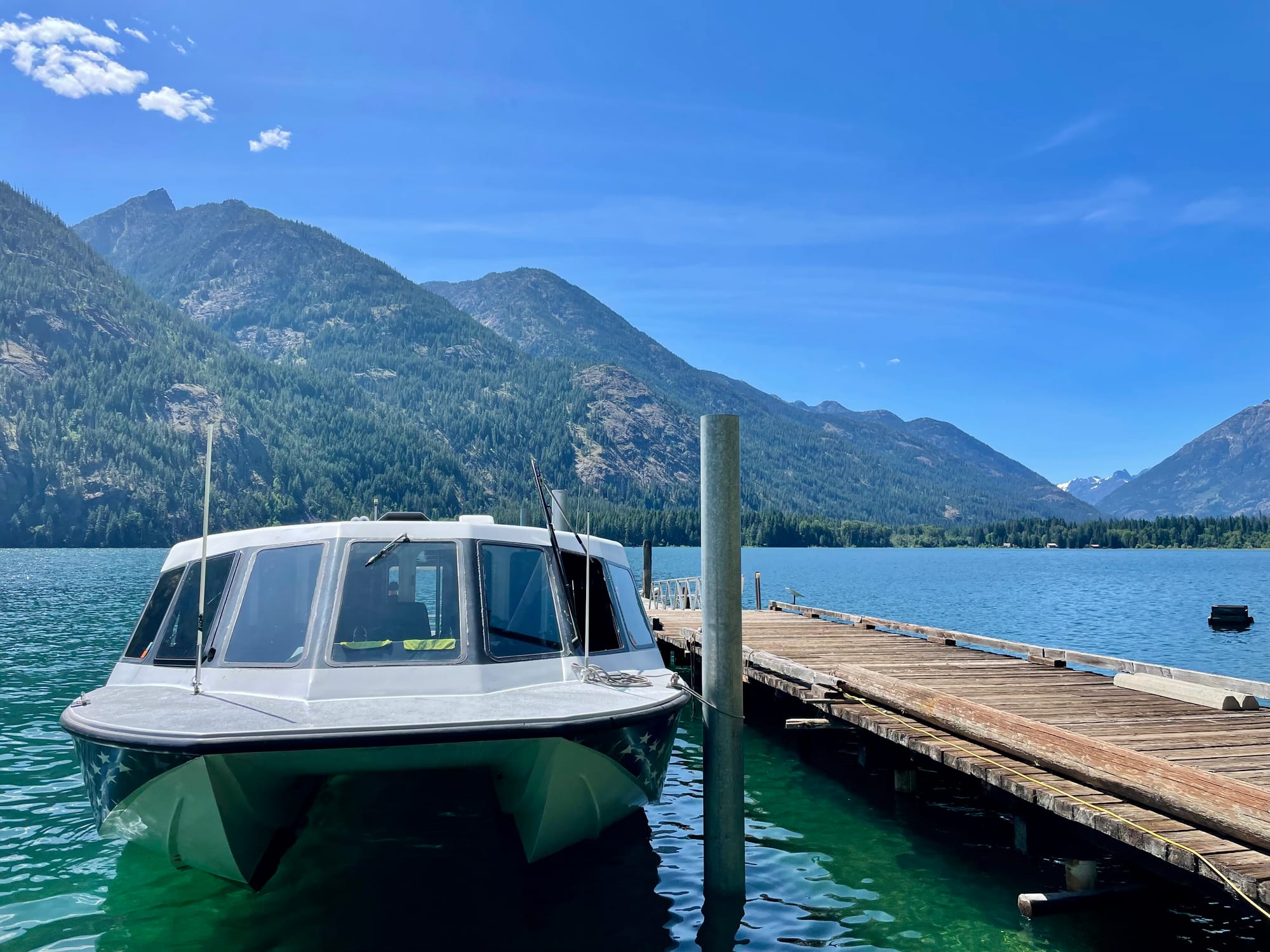
From the bakery, it is a quick paddle from the bakery down the short remainder of the Stehekin and across the top of the Lake Chelan to the ferry dock. Since we did not have full-size kayaks with us, only backpacks, we were able to catch the Lady Liberty, a fast ferry ripping down Lake Chelan at 40 knots. Just under an hour later, we were at Taylor's car, and heading to pick up my truck at the trailhead.
Stehekin Retrospective
In retrospect, this was an incredible trip in an astoundingly beautiful place. I consider myself so incredibly lucky to be close enough to do this trip simply on a long weekend. Now, having done this trip once, I am not sure I would do this 4.5 hour one-way shuttle and the innumerable portages again.
Knowing what I do now, if somebody wanted to do the trip from the top, I would simply plan on walking to the confluence with Flat creek, and if possible, convince somebody to drive shuttle to not have to do the shuttle twice, once on each end like we did. The journey from Cascade trailhead over the pass and down the valley is well worth it. The upper valley is absolutely spectacular. However, it likely is better simply as a backpacking trip without carrying the additional gear to packraft.
The best part of the trip, from a paddling perspective, was from the confluence with Bridge Creek to Stehekin. At lower water, Tumwater very like will go with packrafts when the holes are less sticky. Based on this, hiking up from the bottom, from Stehekin, very well may be the best way to packraft the Stehekin.
This trip perfectly embodies what fascinates me so much about the potential packrafting presents. Prior to packrafts, this trip would be, at best, extremely difficult. Hiking eight miles over Cascade Pass would be miserably difficult with hard shell kayaks. The over 20 portages, both carrying the boats and getting in and out of them, would be a lot more difficult with loaded hard shell kayaks. In our case, Taylor and I likely would have paddled Tumwater if in hard shells, but otherwise, packrafts are what made this trip possible. They worked exactly as advertised, and have me exited about the potential for future trips. Already I am looking at maps, coming up with more ideas, and contemplating who I might be able to talk into these ideas.