Outdoor Geography - Again

The real reason I became interested in Geographic Information Systems (GIS) had nothing to do with getting a job. It had everything to do with wandering around in the woods, finding things, and getting back to them. Strangely, in the interim, somehow I now find myself inside (in a basement no less!) writing code to perform analysis most of the time.
My interest in discovering places and getting back to them has not waned, and although my proficiency with GIS is dramatically better than when I first started exploring GIS during the Clinton administration, I somehow have not been taking advantage of the skills and resources I now have. Recently, I decided to change this.
I work for Esri, and as a result, have access to a massive array of software for Geographic analysis and mapping. Part of this array of software includes a suite of mobile applications. Esri's strategy as of late has been to consolidate into dramatically fewer mobile applications, notably pulling together the functionality previously found in ArcGIS Explorer and ArcGIS Collector into a single application, ArcGIS Field Maps.
While I have toyed around with making a few maps for wandering around in the woods in the past, this release of Field Maps motivated me to revisit this exercise yet again. One of the best ways to learn, after all, is to do...dogfooding.
Esri has an entire ArcGIS Learn Pathway detailing the entire Field Maps workflow to create a Feature Service, create a map, create a Field Maps project, collect data using the Field Maps application, and create a map for display. It details the process of setting up and reporting results for a hypothetical geology lab class trip to the field.
Although I already knew a decent amount about how to configure and use the Field Maps web and mobile applications, I did learn a few new tricks by following this Learn Path - notably how to configure form input. Hence, I definitely recommend walking through it to pick up a few tricks even if you already know how to use Field Maps.
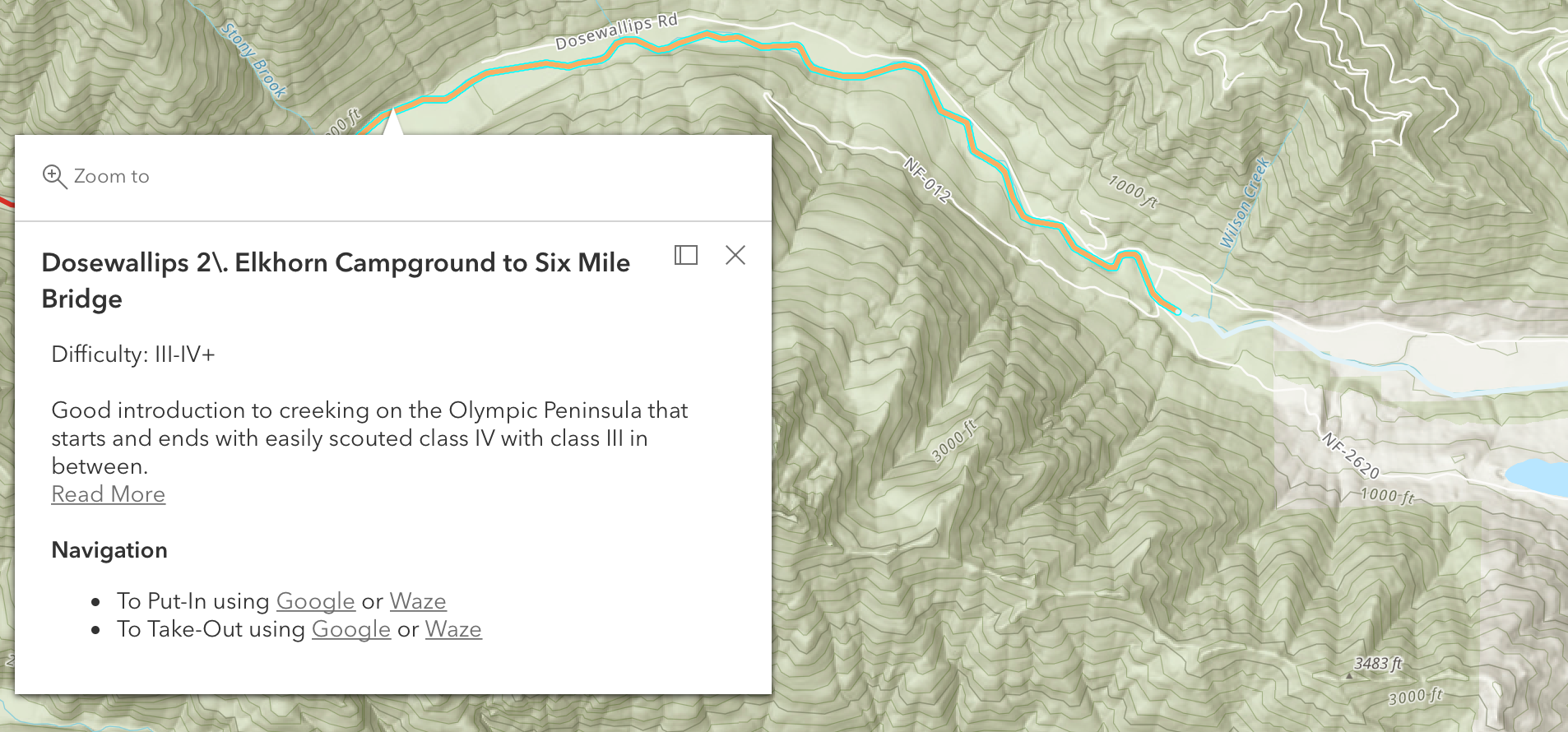
Taking the same idea, I applied it to my interest in recalling where things are and how to get back to them in the woods. In particular, I like to remember where cool primitive campsites are, and also where river accesses are. Especially where we live in the Pacific Northwest, although a river may not be far from the road, you have no clue if you can get to it or not due to the incredibly dense vegetation. Further, recalling exactly where to stop along a densely forested gravel road and start dragging a boat through the temperate jungle is rather hard to recall one season to the next.
Using the workflow detailed above, I created a few Feature Services on ArcGIS Online for River Accesses, Camps, Swimming Holes, and a catch-all General POI. If you want to argue about the usefulness of swimming holes for the Pacific Northwest, try living in a place where most of the buildings (including our house) do not have air conditioning, and dealing with a heatwave like this year with temperatures in the triple digits (over 37°C if you live outside the US). Swimming holes are important.
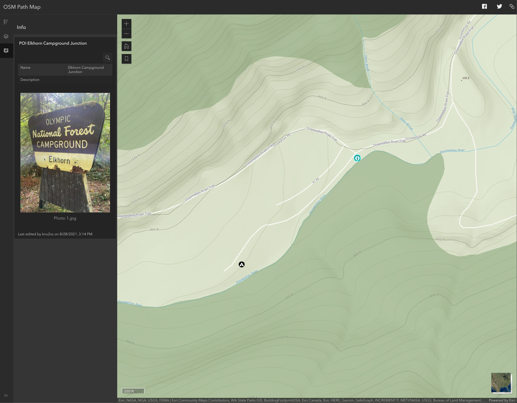
You can view the end result here, a viewer I am populating with data collected using my phone. The best part is, I do not need to have a connection to collect points. Thus, I switch my phone to airplane mode once I get to a trailhead hiking, and my phone typically easily lasts a weekend because it conserves battery by not trying to get a signal the entire time.