Geography Matters...Again
When the world was big, geography mattered a whole lot. As travel became easier, trade almost trivial, and the world became smaller, geographic interest waned. Now, in the midst of a pandemic, suddenly geography matters a lot...again.

When the world was big, and it took a long time to get anywhere, geography mattered a whole awful lot. As travel became easier, trade almost trivial, and the world became smaller, geographic interest progressively waned. Now, in the midst of a worldwide pandemic, when the world seems way too small and interconneted, suddenly geography matters a whole awful lot...again.
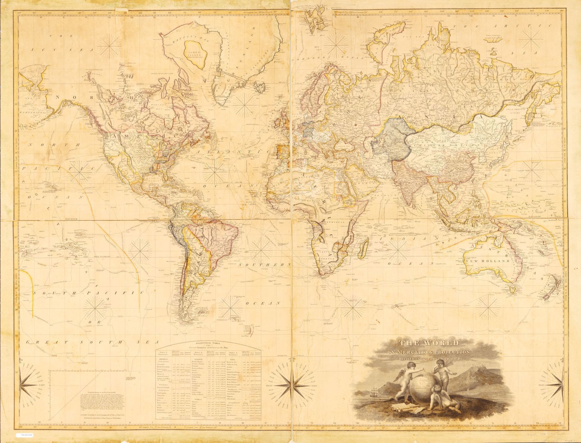
The Age of Exploration - When the World Was Big and Geography Mattered
Lasting from the late 14th through the 17th century, The Age of Exploration was driven by economic ambitions. Most notably when the Ottoman Empire took over Constananople, this blocked the silk road, and Europeans were forced to find a new route to Asia. In a relatively short time span, the world Europe knew grew expodentially in their quest to feed the expanding economic engine of capitalism. Much of this was also enabled by technological strides made in geography and shipbuilding.

New lands, people and cultures were constantly being discovered. It was during this time the Europeans theorized the Earth was a sphere, and Magellan proved it with an expedition circumnavigating the globe. Maps were constantly being created to document newly discovered lands. Something was always being discovered.
The world was big. Geography mattered.
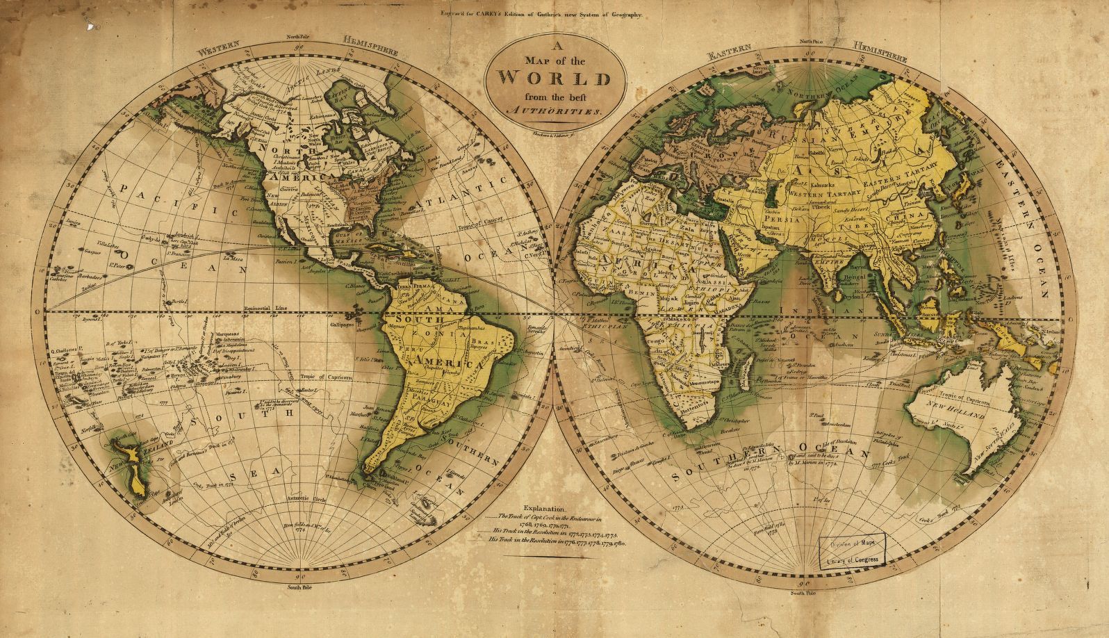
Travel and Technlogy Shrinking the World
Magellan departed Spain on 20 Sep 1519 with three ships and roughly 270 men. Almost exactly three years later, his expedition successfully circumnavigated the globe, returning with one ship and less than 20 men not even including Magellan himself. Today, it is possible to circumnavigate the globe in less than 60 hours in relative comfort. Personally, my work has taken me to Japan, Quatar, and Germany just to facilitate knowledge transfer in-person. Each time I was only there for a week, and sleeping my own bed never more than a day after working with clients. Geographic separation had become little more than a logistical hurdle to surmount for meeting face-to-face.
Communication technologies frequently make this travel unnecessary. Two days ago, I participated in a very productive meeting with participants in Washington state, California, the United Kingdom and Singapore simultaniously. While I have been using virtual meeting technologies regularly for nearly a decade, even I had to muse at how productive and seamless this was. In a way, where we were, our geographic relationships, did not seem to matter much.
Supply chains now span the globe. The example almost everybody is familiar with is the Apple iPhone supply chain, where it is cheaper to build phones in China from materials frequently sourced in Africa to sell around the world, and especially in the United States. The most cost effective supply chains ship materials around the world to the cheapest labor, and ship the product to customers around the world from there. Geography for commerce, similarly, is merely a logistical hurdle.
Ease of travel and communication for both pleasue, business and commerce has faded geography from the forefront. In many ways, geography felt somewhat less relevant outside of specific realms. This suddenly changed in March 2020. The novel coronavirus, now offically SARS-CoV-2, originating in Whuhan, China, has swept across the globe and is officially a worldwide pandemic.
Geography Matters - Because COVID
In January 2020, Ensheng Dong, a first year PhD student at John's Hopkins University (JHU) from the Shanxi provence of China was concerned about something he was hearing about at home, an unfolding situation sounding eerily similar to SARS in 2003. A day later, he built the first map and dashboard displaying the spread of this new disease. Less than a month later, as updates to the map continued and the disease was spreading around the globe, the JHU coronavirus dashboard had become the de-facto authoratative source used around the world to track and understand the unfolding pandemic. Other resources emerged, but the JHU dashboard was the model, the pattern followed, for all subsequent SARS-CoV-2 maps and dashboards.
As a geographer working in Geographic Information Systems (GIS), conversations with the person in the seat next to me on a plane about what I do, at some point, typically elicit the response, "Oh, you mean like Google Maps?" While Google Maps shows a map, it is definitely not a geographic analysis tool, and has no provision for any way to efficiently store geographic data. This is only the start of my critiques, but you likely get the point.
Now, all I have to do is mention the JHU Coronavirus Dashboard, and people instantly understand what I do and why geography matters. This is interesting. Understanding the relevance, why it matters so much where the pandemic is growing and declining, the importance is intuitive. I do not have to explicitly call out this importance, or even call it out by name, but now, quite suddenly, geography matters.
Right now, since apparently mask wearing and social distancing has become a politcal issue, areas of Washington state where these preventative behaviors have been eschewed have reversed the downward trend Washington acheived earlier in the year, and the growth started in eastern Washington. Sadly, the initial growth initially almost perfectly correlated with political preferences, and the associated behaviors. Now, people intuitively understand the relevance of this. Here in Washington, if you are from the area referred to as the Tri-Cities (Kennewick, Pasco, and Richland) in the southeast, or Yakima in central eastern Washinton, people will instantly give you more space. These areas are where SARS-CoV-2 cases are expodentially growing with little sign of slowing. Intuitively people understand geography matters.
Geography is the study of places and the relationships between people and their environments. Geographers explore both the physical properties of Earth’s surface and the human societies spread across it. They also examine how human culture interacts with the natural environment and the way that locations and places can have an impact on people. Geography seeks to understand where things are found, why they are there, and how they develop and change over time.
- National Geographic
SARS-CoV-2, the novel coronavirus, requires people to be in the same place to spread. Thus, understanding where the virus is, where people are going, and how they are interacting, is essential to understanding where the disease is, and could spread. Understanding, tracking and quantifying these aspects, all of this is inherntly a geographic problem, and a problem the technology of geography, GIS, is uniquely suited to address.
Simply visualizing data on a map, as we are seeing with the JHU dashboard, is able to provide valuable actionable information. Global international travel policies have dramatically changed in response to understanding where this pandemic is being contained, and where it is not.
Where I live in Washington state, in January and even into early February, it was common for people to drive up to Whistler in Canada for a ski weekend. Now, British Columbia, which normally is an easy weekend road trip, is completely off limits due to Canada closing the border. While not far away on the map, right now visiting Canada for me is almost as likely as visiting the moon, because geography matters.
Further, because GIS is so well suited to quantify and store both categorical and quantitative geographic charactersitics, GIS is also perfectly suited for epidemilogical modeling - modeling the spread of the disease. Epidemilogical modeling enables informed decision making. This can include hospital surge capacity planning along with exploring public policy hypotheticals.
While there are geographic limitations and it requires some expertise to get reliable results, the CHIME model in ArcGIS Pro and in ArcGIS Insights has proven to be invaluable for hospital surge capacity planning, and clearly communicating the results of these analyses for timely response. Yes, I do work for Esri, and the response we have had across the organization to this crisis makes me proud. While yes, we do charge for software, in response to COVID we have given away massive amounts of software as part of Esri's Disaster Response Program. Also, with a large number of government organizations already using Esri software, all of the CHIME scripts and tools are being given away to use in software these organizations already have because, informed geographic decision making saves lives. Again, geograpy matters.
Professionally, I am first and foremost a geographer. I always have, and always will believe geography matters. Right now though, in the midst of struggling through the novel coronavirus, more than ever, geography matters, and everybody understands why.